|
Ashby map
Historical town map of Ashby, reproduced from the 1875 Beers Atlas of Middlesex County, Massachusetts (MA).
$12.00 - $18.00
|
|
Townsend map
Historical town map of Townsend, reproduced from the 1875 Beers Atlas of Middlesex County. Massachusetts (MA).
$12.00 - $18.00
|
|
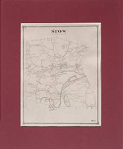
Reproduced from the 1875 Beers Atlas of Middlesex County
$12.00 - $18.00
|
|
Pepperell map
Historical town map of Pepperell, reproduced from the 1875 Beers Atlas of Middlesex County, Massachusetts (MA).
$12.00 - $18.00
|
|
Reproduced from the 1875 Beers Atlas of Middlesex County
$12.00 - $18.00
|
|
Dunstable map
Historical town map of Dunstable, reproduced from the 1875 Beers Atlas of Middlesex County, Massachusetts (MA).
$12.00 - $18.00
|
|
Tyngsborough map
Historical town map of Tyngsborough, reproduced from the 1875 Beers Atlas of Middlesex County. Massachusetts (MA).
$12.00 - $18.00
|
|
Historical town map of Dracut, reproduced from the 1875 Beers Atlas of Middlesex County, Massachusetts (MA).
$12.00 - $18.00
|
|
Reproduced from the 1875 Beers Atlas of Middlesex County
$12.00 - $18.00
|
|
Shirley map
Historical town map of Shirley, reproduced from the 1875 Beers Atlas of Middlesex County, Massachusetts (MA).
$12.00 - $18.00
|
|
Groton map
Historical town map of Groton, reproduced from the 1875 Beers Atlas of Middlesex County, Massachusetts (MA).
$12.00 - $18.00
|
|
Reproduced from the 1875 Beers Atlas of Middlesex County
$12.00 - $18.00
|
|
Westford map
Historical town map of Westford, reproduced from the 1875 Beers Atlas of Middlesex County, Massachusetts (MA).
$12.00 - $18.00
|
|
Reproduced from the 1875 Beers Atlas of Middlesex County
$12.00 - $18.00
|
|
Chelmsford map
Historical old town map of Chelmsford, reproduced from the 1875 Beers Atlas of Middlesex County, Massachusetts (MA).
$12.00 - $18.00
|
|
This historical old Chelmsford map was reproduced from the 1875 Beers Atlas of Middlesex County, Massachusetts (MA).
$12.00 - $18.00
|
|
Reproduced from the 1875 Beers Atlas of Middlesex County
$12.00 - $18.00
|
|
Billerica map
Historical town map of Billerica, reproduced from the 1875 Beers Atlas of Middlesex County, Massachusetts (MA).
$12.00 - $18.00
|
|
Reproduced from the 1875 Beers Atlas of Middlesex County
$12.00 - $18.00
|
|
Reproduced from the 1875 Beers Atlas of Middlesex County
$12.00 - $18.00
|
|
Tewksbury map
Historical town map of Tewksbury, Massachusetts (MA), reproduced from the 1875 Beers Atlas of Middlesex County.
$12.00 - $18.00
|
|
Reproduced from the 1875 Beers Atlas of Middlesex County
$12.00 - $18.00
|
|
Wilmington map
Historical town map of Wilmington, Massachusetts (MA), reproduced from the 1875 Beers Atlas of Middlesex County.
$12.00 - $18.00
|
|
North Reading map
Historical town map of North Reading, Massachusetts (MA), reproduced from the 1875 Beers Atlas of Middlesex County.
$12.00 - $18.00
|
|
Reproduced from the 1875 Beers Atlas of Middlesex County
$12.00 - $18.00
|
|
Reproduced from the 1875 Beers Atlas of Middlesex County
$12.00 - $18.00
|
|
Ayer map
Historical town map of Ayer, Massachsuetts, reproduced from the 1875 Beers Atlas of Middlesex County.
$12.00 - $18.00
|
|
Reproduced from the 1875 Beers Atlas of Middlesex County
$12.00 - $18.00
|
|
Reproduced from the 1875 Beers Atlas of Middlesex County
$12.00 - $18.00
|
|
Littleton map, Boxborough map, Boxboro map
Historical town map of Littleton and Boxborough (Boxboro), Massachusetts (MA), reproduced from the 1875 Beers Atlas of Middlesex County.
$12.00 - $18.00
|
|
Acton map
Historical town map of Acton, Massachusetts (MA), reproduced from the 1875 Beers Atlas of Middlesex County.
$12.00 - $18.00
|
|
Reproduced from the 1875 Beers Atlas of Middlesex County
$12.00 - $18.00
|
|
Carlisle map
Historical town map of Carlisle, Massachusetts (MA), reproduced from the 1875 Beers Atlas of Middlesex County.
$12.00 - $18.00
|
|
Bedford map
Historical town map of Bedford, Massachusetts (MA), reproduced from the 1875 Beers Atlas of Middlesex County.
$12.00 - $18.00
|
|
Reproduced from the 1875 Beers Atlas of Middlesex County
$12.00 - $18.00
|
|
Reproduced from the 1875 Beers Atlas of Middlesex County
$12.00 - $18.00
|
|
Burlington map
Historical town map of Burlington, Massachusetts (MA), reproduced from the 1875 Beers Atlas of Middlesex County.
$12.00 - $18.00
|
|
Woburn map
Historical town map of Woburn, Massachusetts (MA), reproduced from the 1875 Beers Atlas of Middlesex County.
$12.00 - $18.00
|
|
Reproduced from the 1875 Beers Atlas of Middlesex County
$12.00 - $18.00
|
|
Reproduced from the 1875 Beers Atlas of Middlesex County
$12.00 - $18.00
|
|
Stoneham map
Historical town map of Stoneham, Massachusetts (MA), reproduced from the 1875 Beers Atlas of Middlesex County.
$12.00 - $18.00
|
|
Reproduced from the 1875 Beers Atlas of Middlesex County
$12.00 - $18.00
|
|
Wakefield map
Historical town map of Wakefield, Massachusetts (MA), reproduced from the 1875 Beers Atlas of Middlesex County.
$12.00 - $18.00
|
|
Reproduced from the 1875 Beers Atlas of Middlesex County
$12.00 - $18.00
|
|
Reproduced from the 1875 Beers Atlas of Middlesex County
$12.00 - $18.00
|
|
Melrose map
Historical town map of Melrose, Massachusetts (MA), reproduced from the 1875 Beers Atlas of Middlesex County. (Very few family names)
$12.00 - $18.00
|
|
Reproduced from the 1875 Beers Atlas of Middlesex County
$12.00 - $18.00
|
|
Concord map
Historical town map of Concord, Massachusetts (MA), reproduced from the 1875 Beers Atlas of Middlesex County.
$12.00 - $18.00
|
|
Reproduced from the 1875 Beers Atlas of Middlesex County
$12.00 - $18.00
|
|
Lincoln map
Historical town map of Lincoln, Massachusetts (MA), reproduced from the 1875 Beers Atlas of Middlesex County.
$12.00 - $18.00
|
 Old Maps of New England & New York