| |
|
|
 |
Connecticut
Reproductions of old maps of towns and villages in Connecticut, from county atlases published in the late 1800s. Most maps show the family name on each house.
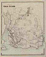
Also shown: schools, factories, railroad tracks and stations, churches, saw- and grist-mills, etc. Maps are available from these county atlases:
Old New London County maps from the Atlas of New London County, published in 1868 by Beers, Ellis & Soule
Old New Haven County maps from the Atlas of New Haven County, published in 1868 by F. W. Beers
Old Old Hartford County maps from the Atlas of Hartford & Tolland Counties, published in 1869 by Baker & Tilden
Old Tolland County maps from the Atlas of Hartford & Tolland Counties, published in 1869 by Baker & Tilden
Old Litchfield County maps from the Atlas of Litchfield County, published in 1874 by F. W. Beers
Old Fairfield County maps from the Atlas of New York & Vicinity, published in 1867 by Beers, Ellis & Soule
Old Middlesex County maps, from the Atlas of Middlesex County, published in 1874 by F. W. Beers
Old Windham County maps from the Atlas of Windham County, published in 1869 by Gray
| Categories |
|---|
Maps for Genealogy: Old maps of Fairfield County towns, reproduced from the Atlas of new York & Vicinity, published in 1867 by Beers, Ellis & Soule.
|
|
|
|
|
|
|
Old maps of New London County towns
|
|
|
|
|
| Products |
|---|
|
This historical old Wethersfield map is reproduced from the Atlas of Hartord & Tolland Counties, Connecticut (CT), published in 1869 by Baker & Tilden.
$15.00 - $21.00
|
|
Reproduced from the Atlas of Hartord & Tolland Counties, published in 1869 by Baker & Tilden.
$15.00 - $21.00
|
|
This historical old Berlin map is reproduced from the Atlas of Hartord & Tolland Counties, Connecticut (CT), published in 1869 by Baker & Tilden.
$15.00 - $21.00
|
|
This historical old New Britain map is reproduced from the Atlas of Hartord & Tolland Counties, Connecticut (CT), published in 1869 by Baker & Tilden.
$15.00 - $21.00
|
|
This historical old New Britain map is reproduced from the Atlas of Hartord & Tolland Counties, Connecticut (CT), published in 1869 by Baker & Tilden.
$15.00 - $21.00
|
|
This historical old Southingtonmap was reproduced from the Atlas of Hartord & Tolland Counties, Connecticut (CT), published in 1869 by Baker & Tilden.
$15.00 - $21.00
|
|
Reproduced from the Atlas of Hartord & Tolland Counties, published in 1869 by Baker & Tilden.
$15.00 - $21.00
|
|
Reproduced from the Atlas of Hartord & Tolland Counties, published in 1869 by Baker & Tilden.
$15.00 - $21.00
|
|
This historical old Farmington map is reproduced from the Atlas of Hartord & Tolland Counties, Connecticut (CT), published in 1869 by Baker & Tilden.
$15.00 - $21.00
|
|
Reproduced from the Atlas of Hartord & Tolland Counties, published in 1869 by Baker & Tilden.
$15.00 - $21.00
|
|
Reproduced from the Atlas of Hartord & Tolland Counties, published in 1869 by Baker & Tilden.
$15.00 - $21.00
|
|
This historical old West Hartford map is reproduced from the Atlas of Hartord & Tolland Counties, Connecticut (CT), published in 1869 by Baker & Tilden.
$15.00 - $21.00
|
|
This historical old Bloomfield map is reproduced from the Atlas of Hartord & Tolland Counties, Connecticut (CT), published in 1869 by Baker & Tilden.
$15.00 - $21.00
|
|
This historical old East Granby map is reproduced from the Atlas of Hartord & Tolland Counties, Connecticut (CT), published in 1869 by Baker & Tilden.
$15.00 - $21.00
|
|
This historical old Granby map is reproduced from the Atlas of Hartord & Tolland Counties, Connecticut (CT), published in 1869 by Baker & Tilden.
$15.00 - $21.00
|
|
This historical old Hartland map is reproduced from the Atlas of Hartord & Tolland Counties, Connecticut (CT), published in 1869 by Baker & Tilden.
$15.00 - $21.00
|
|
This historical old Canton map is reproduced from the Atlas of Hartord & Tolland Counties, Connecticut (CT), published in 1869 by Baker & Tilden.
$15.00 - $21.00
|
|
Reproduced from the Atlas of Hartord & Tolland Counties, published in 1869 by Baker & Tilden.
$15.00 - $21.00
|
|
This historical old Simsbury map is reproduced from the Atlas of Hartord & Tolland Counties, Connecticut (CT), published in 1869 by Baker & Tilden.
$15.00 - $21.00
|
|
Reproduced from the Atlas of Hartord & Tolland Counties, published in 1869 by Baker & Tilden.
$15.00 - $21.00
|
|
This historical old Bristol map is reproduced from the Atlas of Hartord & Tolland Counties, Connecticut (CT), published in 1869 by Baker & Tilden.
$15.00 - $21.00
|
|
This historical old Burlington map is reproduced from the Atlas of Hartord & Tolland Counties, Connecticut (CT), published in 1869 by Baker & Tilden.
$15.00 - $21.00
|
|
This historical old Avon map is reproduced from the Atlas of Hartord & Tolland Counties, Connecticut (CT), published in 1869 by Baker & Tilden.
$15.00 - $21.00
|
|
Reproduced from the Atlas of Hartord & Tolland Counties, published in 1869 by Baker & Tilden.
$15.00 - $21.00
|
|
This historical old Mansfield map is reproduced from the Atlas of Hartord & Tolland Counties, Connecticut (CT), published in 1869 by Baker & Tilden.
$15.00 - $21.00
|
|
This historical old Coventry map is reproduced from the Atlas of Hartord & Tolland Counties, Connecticut (CT), published in 1869 by Baker & Tilden.
$15.00 - $21.00
|
|
This historical old Willington map is reproduced from the Atlas of Hartord & Tolland Counties, Connecticut (CT), published in 1869 by Baker & Tilden.
$15.00 - $21.00
|
|
This historical old Union map is reproduced from the Atlas of Hartord & Tolland Counties, Connecticut (CT), published in 1869 by Baker & Tilden.
$15.00 - $21.00
|
|
This historical old Stafford map is reproduced from the Atlas of Hartord & Tolland Counties, Connecticut (CT), published in 1869 by Baker & Tilden.
$15.00 - $21.00
|
|
This historical old Stafford Springs map is reproduced from the Atlas of Hartord & Tolland Counties, Connecticut (CT), published in 1869 by Baker & Tilden.
$15.00 - $21.00
|
|
This historical old Tolland map is reproduced from the Atlas of Hartord & Tolland Counties, Connecticut (CT), published in 1869 by Baker & Tilden.
$15.00 - $21.00
|
|
This historical old Vernon map is reproduced from the Atlas of Hartord & Tolland Counties, Connecticut (CT), published in 1869 by Baker & Tilden.
$15.00 - $21.00
|
|
Reproduced from the Atlas of Hartord & Tolland Counties, Connecticut (CT), published in 1869 by Baker & Tilden.
$15.00 - $21.00
|
|
This historical old Ellington map is reproduced from the Atlas of Hartord & Tolland Counties, Connecticut (CT), published in 1869 by Baker & Tilden.
$15.00 - $21.00
|
|
This historical old Somers map is reproduced from the Atlas of Hartord & Tolland Counties, Connecticut (CT), published in 1869 by Baker & Tilden.
$15.00 - $21.00
|
|
This historical old Bolton and Andover map is reproduced from the Atlas of Hartord & Tolland Counties, Connecticut (CT), published in 1869 by Baker & Tilden.
$15.00 - $21.00
|
|
This historical old Hebron map is reproduced from the Atlas of Hartord & Tolland Counties, Connecticut (CT), published in 1869 by Baker & Tilden.
$15.00 - $21.00
|
|
This historical old Columbia map is reproduced from the Atlas of Hartord & Tolland Counties, Connecticut (CT), published in 1869 by Baker & Tilden.
$15.00 - $21.00
|
|
This historical old Litchfield County map is reproduced from the Atlas of Litchfield County, Connecticut (CT), 1874, by F. W. Beers
$15.00 - $21.00
|
|
This historical old Salisbury map is reproduced from the Atlas of Litchfield County, Connecticut (CT), 1874, by F. W. Beers
$15.00 - $21.00
|
|
This historical old Canaan and North Canaan map is reproduced from the Atlas of Litchfield County, Connecticut (CT), 1874, by F. W. Beers
$15.00 - $21.00
|
|
Reproduced from the Atlas of Litchfield County, 1874, by F. W. Beers
$15.00 - $21.00
|
|
Reproduced from the Atlas of Litchfield County, Connecticut (CT), 1874, by F. W. Beers
$15.00 - $21.00
|
|
This historical old Norfolk map is reproduced from the Atlas of Litchfield County, Connecticut (CT), 1874, by F. W. Beers
$15.00 - $21.00
|
|
Reproduced from the Atlas of Litchfield County, 1874, by F. W. Beers
$15.00 - $21.00
|
|
This historical old Colebrook map is reproduced from the Atlas of Litchfield County, Connecticut (CT), 1874, by F. W. Beers
$15.00 - $21.00
|
|
This historical old Winchester map is reproduced from the Atlas of Litchfield County, Connecticut (CT), 1874, by F. W. Beers
$15.00 - $21.00
|
|
Reproduced from the Atlas of Litchfield County, Connecticut (CT), 1874, by F. W. Beers
$15.00 - $21.00
|
|
Reproduced from the Atlas of Litchfield County, 1874, by F. W. Beers
$15.00 - $21.00
|
|
This historical old Barkhamstead map is reproduced from the Atlas of Litchfield County, Connecticut (CT), 1874, by F. W. Beers
$15.00 - $21.00
|
|
|
|
|
|
 Old Maps of New England & New York


