|
Vermont map
A very handsome old map. Reproduced from the 1869 Atlas of Windsor County. This historical old Vermont state map shows town and village names, town lines, county names, railroads (Whitehall and Plattsburgh Rail Road, Rutland and Bennington Rail Road, Keene R.R., Sullivan Railroad, Vermont (VT) Central Railroad, Passumpsic River Rail Road, etc.) There are no family names shown.
$15.00 - $21.00
|
|
This historical old Windsor County map was reproduced from the Atlas of Windsor County, Vermont (VT), published by F. W. Beers in 1869.
$15.00 - $21.00
|
|
Rochester map
This historical old Rochester map was reproduced from the Atlas of Windsor County, Vermont (VT), published by F. W. Beers in 1869.
$15.00 - $21.00
|
|
Bethel map
This historical old Bethel map was reproduced from the Atlas of Windsor County, Vermont (VT), published by F. W. Beers in 1869.
$15.00 - $21.00
|
|
This historical old map was reproduced from the Atlas of Windsor County, Vermont (VT), published by F. W. Beers in 1869.
$15.00 - $21.00
|
|
Royalton map
This historical old Royalton map was reproduced from the Atlas of Windsor County, Vermont (VT), published by F. W. Beers in 1869.
$15.00 - $21.00
|
|
Sharon map
This historical old Sharon map was reproduced from the Atlas of Windsor County, Vermont (VT), published by F. W. Beers in 1869.
$15.00 - $21.00
|
|
Norwich map
This historical old Norwich map was reproduced from the Atlas of Windsor County, Vermont (VT), published by F. W. Beers in 1869.
$15.00 - $21.00
|
|
This historical old map was reproduced from the Atlas of Windsor County, Vermont (VT), published by F. W. Beers in 1869.
$15.00 - $21.00
|
|
Stockbridge map
This historical old Stockbridge map was reproduced from the Atlas of Windsor County, Vermont (VT), published by F. W. Beers in 1869.
$15.00 - $21.00
|
|
Barnard map
This historical old Barnard map was reproduced from the Atlas of Windsor County, Vermont (VT), published by F. W. Beers in 1869.
$15.00 - $21.00
|
|
Pomfret map
This historical old Pomfret map was reproduced from the Atlas of Windsor County, Vermont (VT), published by F. W. Beers in 1869.
$15.00 - $21.00
|
|
Hartford map
This historical old Hartford map was reproduced from the Atlas of Windsor County, Vermont (VT), published by F. W. Beers in 1869.
$15.00 - $21.00
|
|
Business Directories for White River Junction, Quechee & White River Village. Reproduced from the Atlas of Windsor County, Vermont (VT), published by F. W. Beers in 1869
$15.00 - $21.00
|
|
Bridgewater map
This historical old Bridgewater map was reproduced from the Atlas of Windsor County, Vermont (VT), published by F. W. Beers in 1869.
$15.00 - $21.00
|
|
This historical old map was reproduced from the Atlas of Windsor County, Vermont (VT), published by F. W. Beers in 1869.
$15.00 - $21.00
|
|
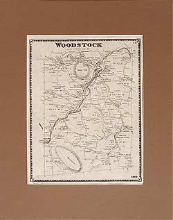
Woodstock map
This historical old Woodstock map was reproduced from the Atlas of Windsor County, Vermont (VT), published by F. W. Beers in 1869.
$15.00 - $21.00
|
|
This historical old Woodstock map was reproduced from the Atlas of Windsor County, Vermont (VT), published by F. W. Beers in 1869.
$15.00 - $21.00
|
|
Hartland map
This historical old Hartland map was reproduced from the Atlas of Windsor County, Vermont (VT), published by F. W. Beers in 1869.
$15.00 - $21.00
|
|
This historical old map was reproduced from the Atlas of Windsor County, Vermont (VT), published by F. W. Beers in 1869.
$15.00 - $21.00
|
|
Plymouth map
This historical old Plymouth map was reproduced from the Atlas of Windsor County, Vermont (VT), published by F. W. Beers in 1869.
$15.00 - $21.00
|
|
Reading map
This historical old Reading map was reproduced from the Atlas of Windsor County, Vermont (VT), published by F. W. Beers in 1869.
$15.00 - $21.00
|
|
West Windsor map, Windsor map
This historical old Windsor and West Windsor map was reproduced from the Atlas of Windsor County, Vermont (VT), published by F. W. Beers in 1869.
$15.00 - $21.00
|
|
Windsor Centre map
This historical old Windsor Centre map was reproduced from the Atlas of Windsor County, Vermont (VT), published by F. W. Beers in 1869.
$15.00 - $21.00
|
|
Ludlow map
This historical old Ludlow map was reproduced from the Atlas of Windsor County, Vermont (VT), published by F. W. Beers in 1869.
$15.00 - $21.00
|
|
This historical old Ludlow map was reproduced from the Atlas of Windsor County, Vermont (VT), published by F. W. Beers in 1869.
$15.00 - $21.00
|
|
Cavendish map, Baltimore map
This historical old Cavendish and Baltimore map was reproduced from the Atlas of Windsor County, Vermont (VT), published by F. W. Beers in 1869.
$15.00 - $21.00
|
|
This historical old map was reproduced from the Atlas of Windsor County, Vermont (VT), published by F. W. Beers in 1869.
$15.00 - $21.00
|
|
This historical old map was reproduced from the Atlas of Windsor County, Vermont (VT), published by F. W. Beers in 1869.
$15.00 - $21.00
|
|
Weathersfield map
This historical old Weathersfield map was reproduced from the Atlas of Windsor County, Vermont (VT), published by F. W. Beers in 1869.
$15.00 - $21.00
|
|
Weston map
This historical old Weston map was reproduced from the Atlas of Windsor County, Vermont (VT), published by F. W. Beers in 1869.
$15.00 - $21.00
|
|
This historical old Andover map was reproduced from the Atlas of Windsor County, Vermont (VT), published by F. W. Beers in 1869.
$15.00 - $21.00
|
|
This historical old Chester map was reproduced from the Atlas of Windsor County, Vermont (VT), published by F. W. Beers in 1869.
$15.00 - $21.00
|
|
This historical old Chester map was reproduced from the Atlas of Windsor County, Vermont (VT), published by F. W. Beers in 1869.
$15.00 - $21.00
|
|
This historical old Springfield map was reproduced from the Atlas of Windsor County, Vermont (VT), published by F. W. Beers in 1869.
$15.00 - $21.00
|
|
This historical old Springfield map was reproduced from the Atlas of Windsor County, Vermont (VT), published by F. W. Beers in 1869.
$15.00 - $21.00
|
 Old Maps of New England & New York