|
This historical old Attleborough map was originally published in the Beers Atlas of Bristol County, in 1871. Alternate spelling: Attleboro.
$15.00 - $21.00
|
This historical old North Attleborough centre map was originally published in the Beers Atlas of Bristol County, in 1871. $15.00 - $21.00
|
This historical old Attleborough map was originally published in the Beers Atlas of Bristol County, in 1871. $15.00 - $21.00
|
This historical old Mansfield map was originally published in the Beers Atlas of Bristol County, in 1871. $15.00 - $21.00
|
This historical old Mansfield map was originally published in the Beers Atlas of Bristol County, in 1871. $15.00 - $21.00
|
This historical old Norton map was originally published in the Beers Atlas of Bristol County, in 1871. $15.00 - $21.00
|
This historical old Easton map was originally published in the Beers Atlas of Bristol County, in 1871. $15.00 - $21.00
|
This historical old Easton map was originally published in the Beers Atlas of Bristol County, in 1871. $15.00 - $21.00
|
This historical old Taunton map was originally published in the Beers Atlas of Bristol County, in 1871. $15.00 - $21.00
|
This historical old Taunton map was originally published in the Beers Atlas of Bristol County, in 1871. $15.00 - $21.00
|
This historical old Raynham map was originally published in the Beers Atlas of Bristol County, in 1871. $15.00 - $21.00
|
This historical old Seekonk map was originally published in the Beers Atlas of Bristol County, in 1871. $15.00 - $21.00
|
This historical old Rehoboth map was originally published in the Beers Atlas of Bristol County, in 1871. $15.00 - $21.00
|
This historical old Dighton map was originally published in the Beers Atlas of Bristol County, in 1871. $15.00 - $21.00
|
This historical old Dighton map was originally published in the Beers Atlas of Bristol County, in 1871. $15.00 - $21.00
|
This historical old Berkley map was originally published in the Beers Atlas of Bristol County, in 1871. $15.00 - $21.00
|
This historical old Somerset and Swansea map was originally published in the Beers Atlas of Bristol County, in 1871. $15.00 - $21.00
|
This historical old Somerset map was originally published in the Beers Atlas of Bristol County, in 1871. $15.00 - $21.00
|
This historical old Fall River map was originally published in the Beers Atlas of Bristol County, in 1871. $15.00 - $21.00
|
|
This historical old Fall River map was originally published in the Beers Atlas of Bristol County, in 1871.
$15.00 - $21.00
|
This historical old Freetown map was originally published in the Beers Atlas of Bristol County, in 1871. $15.00 - $21.00
|
This historical old Westport and Assonet map was originally published in the Beers Atlas of Bristol County, in 1871. $15.00 - $21.00
|
This historical old Westport map was originally published in the Beers Atlas of Bristol County, in 1871. $15.00 - $21.00
|
This historical old Dartmouth map was originally published in the Beers Atlas of Bristol County, in 1871. $15.00 - $21.00
|
This historical old Dartmouth map was originally published in the Beers Atlas of Bristol County, in 1871. $15.00 - $21.00
|
This historical old New Bedford map was originally published in the Beers Atlas of Bristol County, in 1871. $15.00 - $21.00
|
|
Reproduced from the 1871 Beers Atlas of Bristol County
$15.00 - $21.00
|
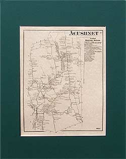
This historical old Acushnet map was originally published in the Beers Atlas of Bristol County, in 1871. $15.00 - $21.00
|
This historical old Fair Haven map was originally published in the Beers Atlas of Bristol County, in 1871. $15.00 - $21.00
|
This historical old Fair Haven map was originally published in the Beers Atlas of Bristol County, in 1871. $15.00 - $21.00
|
Title: Old Colony Line Map of Martha's Vineyard and the Summer Resorts of Buzzard's Bay and Vineyard Sound by H. F. Walling, 103 Chauncy Street, Boston.
Originally part of an advertising folder, this Old Colony Line map covers the area from Wareham and Sandwich on the north, to Martha's Vineyard on the south, from Mattapoisett and part of the Elizabeth Islands (Pasque and Naushon islands) on the west, to Marshpee (Mashpee) on the east. The ferry route is shown, and many localities are named. $15.00 - $21.00
|
 Old Maps of New England & New York