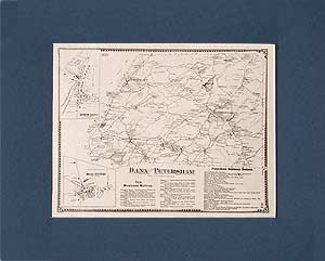
|
Brookfield map
This historical old Brookfield map was originally published in 1870 in the Atlas of the Worcester County, Massachusetts (MA), by F. W. Beers. In 1870 East Brookfield was still part of Brookfield About East Brookfield: East Brookfield was first settled in 1664 as part of the what was known as Quabog Plantation lands. It later became part of the new town of Brookfield in 1673, and was not officially incorporated as a separate town until 1920, making it the "newest" town (by date of in the state of Massachusetts. $15.00 - $21.00
|
|
Reproduced from the 1870 Atlas of Worcester County by F. W. Beers.
$15.00 - $21.00
|
|
Spencer map
This historical old Spencer map was originally published in 1870 in the Atlas of the Worcester County, Massachusetts (MA), by F. W. Beers. $15.00 - $21.00
|
|
This historical old map of the villages of Spencer and Oxford is reproduced from the Atlas of Worcester County published in 1870.
$15.00 - $21.00
|
|
Leicester map
This historical old Leicester map was originally published in 1870 in the Atlas of the Worcester County, Massachusetts (MA), by F. W. Beers. $15.00 - $21.00
|
|
Reproduced from the 1870 Atlas of Worcester County by F. W. Beers.
$15.00 - $21.00
|
|
Worcester map
This historical old Worcester map was originally published in 1870 in the Atlas of the Worcester County, Massachusetts (MA), by F. W. Beers. $15.00 - $21.00
|
|
This historical old map of the central part of Worcester was reproduced from the Atlas of Worcester County published in 1870.
$15.00 - $21.00
|
|
Reproduced from the 1870 Atlas of Worcester County by F. W. Beers.
$15.00 - $21.00
|
|
Shrewsbury map
This historical old map of Shrewsbury was reproduced from the Atlas of Worcester County, Massachusetts (MA), published in 1870 by F. W. Beers.
$15.00 - $21.00
|
|
Northborough map, Westborough map
This historical old Northborough and Westborough map was originally published in 1870 in the Atlas of the Worcester County, Massachusetts (MA), by F. W. Beers. $15.00 - $21.00
|
|
Reproduced from the 1870 Atlas of Worcester County by F. W. Beers.
$15.00 - $21.00
|
|
Reproduced from the 1870 Atlas of Worcester County by F. W. Beers.
$15.00 - $21.00
|
|
Southborough map, Southboro map
This historical old Southborough map was originally published in 1870 in the Atlas of the Worcester County, Massachusetts (MA), by F. W. Beers. $15.00 - $21.00
|
|
Sturbridge map, Southbridge map
This historical old Southbridge and Sturbridge map was originally published in 1870 in the Atlas of the Worcester County, Massachusetts (MA), by F. W. Beers. $15.00 - $21.00
|
|
Reproduced from the 1870 Atlas of Worcester County by F. W. Beers.
$15.00 - $21.00
|
|
Reproduced from the 1870 Atlas of Worcester County by F. W. Beers.
$15.00 - $21.00
|
|
Charlton map
This historical old Charlton map was originally published in 1870 in the Atlas of the Worcester County, Massachusetts (MA), by F. W. Beers. $15.00 - $21.00
|
|
Oxford map
OXFORD MA MAP: This historical old Oxford map was originally published in 1870 in the Atlas of the Worcester County, Massachusetts (MA), by F. W. Beers. $15.00 - $21.00
|
|
Auburn map, Millbury map
This historical old Millbury and Auburn map was originally published in 1870 in the Atlas of the Worcester County, Massachusetts (MA), by F. W. Beers. $15.00 - $21.00
|
|
Reproduced from the 1870 Atlas of Worcester County by F. W. Beers.
$15.00 - $21.00
|
|
Reproduced from the 1870 Atlas of Worcester County by F. W. Beers.
$15.00 - $21.00
|
|
Sutton map
This historical old Sutton map was originally published in 1870 in the Atlas of the Worcester County, Massachusetts (MA), by F. W. Beers. $15.00 - $21.00
|
|
Grafton map
This historical old Grafton map was originally published in 1870 in the Atlas of the Worcester County, Massachusetts (MA), by F. W. Beers. $15.00 - $21.00
|
|
Reproduced from the 1870 Atlas of Worcester County by F. W. Beers.
$15.00 - $21.00
|
|
Northbridge map
This historical old Northbridge map was originally published in 1870 in the Atlas of the Worcester County, Massachusetts (MA), by F. W. Beers. $15.00 - $21.00
|
|
Reproduced from the 1870 Atlas of Worcester County by F. W. Beers.
$15.00 - $21.00
|
|
Upton map
This historical old Upton map was originally published in 1870 in the Atlas of the Worcester County, Massachusetts (MA), by F. W. Beers. $15.00 - $21.00
|
|
Milford map
This historical old Milford map was originally published in 1870 in the Atlas of the Worcester County, Massachusetts (MA), by F. W. Beers. $15.00 - $21.00
|
|
Reproduced from the 1870 Atlas of Worcester County by F. W. Beers.
$15.00 - $21.00
|
|
Mendon map
This historical old Mendon map was originally published in 1870 in the Atlas of the Worcester County, Massachusetts (MA), by F. W. Beers. $15.00 - $21.00
|
|
Dudley map
This historical old Dudley map was originally published in 1870 in the Atlas of the Worcester County, Massachusetts (MA), by F. W. Beers. $15.00 - $21.00
|
|
Webster map
This historical old Webster map was originally published in 1870 in the Atlas of the Worcester County, Massachusetts (MA), by F. W. Beers. $15.00 - $21.00
|
|
This historical old map of the villages of Merino Village and Chaseville within the town of Webster, was reproduced from the Atlas of Worcester County pubished in 1870.
$15.00 - $21.00
|
|
Douglas map
This historical old Douglas map was originally published in 1870 in the Atlas of the Worcester County, Massachusetts (MA), by F. W. Beers. $15.00 - $21.00
|
|
Reproduced from the 1870 Atlas of Worcester County by F. W. Beers.
$15.00 - $21.00
|
|
Uxbridge map
This historical old Uxbridge map was originally published in 1870 in the Atlas of the Worcester County, Massachusetts (MA), by F. W. Beers. $15.00 - $21.00
|
|
Blackstone map
This historical old Blackstone map was originally published in 1870 in the Atlas of the Worcester County, Massachusetts (MA), by F. W. Beers. $15.00 - $21.00
|
|
Reproduced from the 1870 Atlas of Worcester County by F. W. Beers.
$15.00 - $21.00
|
 Old Maps of New England & New York